Oil & gas data provider
Full-featured, interactive chart & mapping software. Production, ownership & well data in a modern, intuitive interface.
Daily Feed
Be the first to know.
Statewide IP, pressure, casing, completion, permits, and formation data. Updated daily.
- Filter by county.
- Focus only on your areas of interest or browse statewide.
- See where the well is.
- Click a well to be take directly to it on the map.
- Updated daily.
- Be the first to know what's happening.
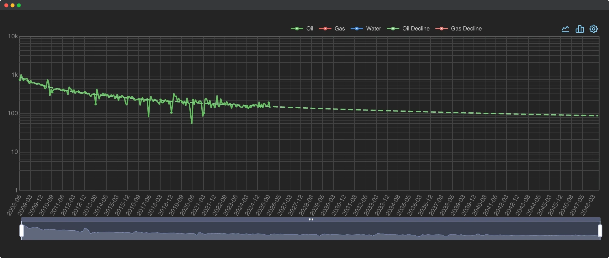
Maps. Charts. Tables.
Visualizations of key industry data to help you further hone your expertise.
Keep track of everyone's deals including production and interactive map of every lease involved.
See the industry like never before.
Whether you're after the big picture or anything else, we make it easy. All with the interface and features you expect from a modern app.
Ownership
For 150 counties in Texas.
Updated yearly, our data is searchable, downloadable, and available on our maps. Critical whether you're buying minerals or signing leases.
Ledger
Every new lease filtered and sorted.
Tables of every new lease in Texas. These are all newly publically available leases no matter how long they've been online.
Leases
Group by county, field, or operator.
Easily find the best lease in a field. See an operator's top leases by per well oil. Find the lease with the most total gas in a county.
For 150 counties in Texas.
Updated yearly, our data is searchable, downloadable, and available on our maps. Critical whether you're buying minerals or signing leases.
Every new lease filtered and sorted.
Tables of every new lease in Texas. These are all newly publically available leases no matter how long they've been online.
Group by county, field, or operator.
Easily find the best lease in a field. See an operator's top leases by per well oil. Find the lease with the most total gas in a county.
Get started today
Our free trial lets you evaluate risk free. Experience what 30 years of industry knowledge has to offer.
Get 4 weeks freePricing
Plans for teams of all sizes
Free
$0/month
Buy plan- District Production
- Permits Map
- County Activity Table
Independent
$250/month
Buy plan- District Production
- Permits Map
- County Activity Table
- Production
- Maps
- Ownership
- Deals
- CSV Downloads
- Regulatory Documents
- Legal Instruments
Company
$500/month
Buy plan- District Production
- Permits Map
- County Activity Table
- Production
- Maps
- Ownership
- Deals
- CSV Downloads
- Regulatory Documents
- Legal Instruments
- Priority
- Custom Features
Enterprise
Custom
Buy plan- District Production
- Permits Map
- County Activity Table
- Production
- Maps
- Ownership
- Deals
- CSV Downloads
- Regulatory Documents
- Legal Instruments
- Priority
- Custom Features
Frequently asked questions
When will I be charged?
The first 4 weeks are free. After that, a charge will recur monthly.
How do I pay?
Our payments are powered by Stripe.
Can I pay for my subscription via invoice?
Yes, we can send invoices for credit card, check, or wire transfer.
How do I cancel my account?
You can cancel your account easily in the app or we can do so for you.
Can I download the data?
Yes, most data can be downloaded as CSV right in the browser.
What about bulk data purchases?
Email craig@quickscout.io
Who built this app?
Two people with 30 years of experience in exploration & production, operations, and tax evaluations.
Do you offer custom features?
Yes. We would love to discuss your ideas with you. Email craig@quickscout.io
Will you have states other than Texas?
We are working toward offering more states.
How often is your data updated?
Production and legal instruments are monthly. Ownership is yearly. Permits are weekly. Everything else varies.